- Glasgow City Council
- > Roads and Parking
- > Spaces for People
- > Spaces for People - Programme
Spaces for People - Programme
Overview
Introduced at the start of COVID-19 to suppress the spread of the virus and help manage demand on public transport, Glasgow's Spaces for People programme has delivered a significant number of temporary travel interventions across the city to ease physical distancing in public places, mainly through the provision of widened footways, road closures and segregated cycle lanes.
The majority of Spaces for People schemes will now be made permanent following consideration of an independent review which highlighted that the infrastructure can offer long-term active travel and sustainability benefits. You can read more about this here.
In most cases, a Traffic Regulation Order (TRO) will be required to make Spaces for People projects permanent. Details of all Spaces for People TROs proposed by the council (current and completed) can be found here.
This webpage provides an overview of all the infrastructure delivered through the Spaces for People programme, including those measures that have not been permanently retained.
Measures Delivered: City Centre
A street-by-street approach was adopted, with temporary measures introduced to prioritise pedestrian space around our transport centres, core shopping streets and identified pinch points.
Work undertaken included footway widening around Glasgow Central Station High and Low Level entrances to provide additional queuing space, as well as footway widening and road closures in and around George Square, including North Hanover Street at Queen St station. A bus/cycle/taxi gate was added to George Square (south) and South Frederick St (north), and a bus/cycle/taxi lane on Cochrane Street to speed up journeys and support sustainable transport.
Footway widening around core streets within the city centre was also implemented at locations including Hope Street, Union Street and Bath Street as well as Renfield Street and West George Street. Extra space was also created on Montrose Street to support the return of students to college and university.
Following a period of monitoring and review, some measures were removed to allow a focus on the delivery of temporary infrastructure where it was most needed and to improve its look and feel. Larger style planters and trees were subsequently installed around George Square to green the space and restrict vehicle movement.
Complementary work was also undertaken around St Vincent Place, Queen Street and Merchant City.
.jpg)
Other initiatives to ease pedestrian movement in the city centre included the installation of bus boarders - with the first ones installed on Glassford Street outside Marks and Spencer, and at Trongate next to Tesco Express. This infrastructure extends the footway out into the road, ensuring continued accessibility onto public transport whilst providing extra space for pedestrians at noted pinch points.
Full details of all city centre projects delivered can be found here.
Measures Delivered: Neighbourhoods
This element of the programme has freed up pedestrian space where it's most needed such as outside local shops, and has primarily been achieved through the removal of kerbside parking.
Footways were widened at Easterhouse, Cardonald, Tollcross, Parkhead, Cessnock, Shawlands, Bridgeton, Partick (Dumbarton Rd), Finnieston and Byres Road, with some measures adjusted and/or removed following a period of monitoring and review.
Schemes to create 'People Friendly Streets' were delivered at Shawlands, Dennistoun and Pollokshields, with the aim of creating calmer neighbourhoods that have additional space for walking, wheeling and cycling.
We assisted schools, with extra pavement space created outside Lourdes Primary School and Shawlands Primary School to ease congestion at school drop off/pick up time.
Changes were also made to the road layout on Kelvin Way to balance the provision of extra space for walkers, wheelers and cyclists whilst enabling vehicular access into the Kelvingrove Art Gallery and Museum.
.jpg)
Full details of all neighbourhood measures introduced through the Spaces for People programme can be found here.
Measures Delivered: Active Travel
Segregated cycle lanes were introduced to encourage active travel for everyday journeys and to help reduce demand on public transport.
Lanes were installed on the Broomielaw, Dumbreck Road, London Road (Phase 1 and Phase 2), Great Western Road (Duntreath Avenue to Lincoln Avenue), Gorbals Street, Cumbernauld Road, Provanmill Road, Bilsland Drive, Hawthorn Street, Brockburn Road, Braidcraft Road, Cambridge Street and Royston Road.
We also made mandatory, existing cycle lanes on Corkerhill Road, Clarence Drive, Wallacewell Road and Howard Street and added soft segregation.
Other related initiatives include the provision of cycle parking at 50 new locations, such as in George Square and an expansion of Glasgow's popular cycle hire scheme.
Full details of all the cycle lanes introduced through the Spaces for People programme can be found here.
School Car Free Zones
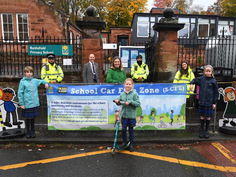
Spaces for People helped to expand the number of School Car Free Zones which prohibit vehicles from driving up to the school gates at peak times, leaving extra space for walking, wheeling and cycling.

Increased Pedestrian Priority at Junctions
We implemented automation and touch-free, measures at crossings to prioritise pedestrians and remove the need to press the button to prompt the green man to display.
Improved Access to Parks and Open Space
We have increased signage within our parks and provided wayfinding on routes to help ease physical distancing, along with vegetation clearance to remove obstructions on public footways.


